Togolok 1 (Turkmenistan)
TAP – Togolok Archaeological Project
Mission Coordinator/Responsible
Barbara Cerasetti (ISMEO - The International Association for Mediterranean and Oriental Studies; DiSCi - University of Bologna) e Maurizio Cattani (DiSCi – University of Bologna)
Research area and second level ERC sectors
- Archaeology from pre and protohistory to Medieval Age
- SH3 Environment, space and population: environmental studies, geography, demography, populations, migrations, regional and urban studies (2 III level)
SH3-12 Geo-information and spatial data analysis
SH6 Study of the past: archaeology, history and memory (12 III level)
SH6-2 Prehistory and protohistory
Start and period of the excavation
The Italian-Turkmen research project in the alluvial fan of the Murghab River (southern Turkmenistan) began in 1990 with the creation of the archaeological map (AMMD - The Archaeological Map of the Murghab Delta Project) by using a GIS system. This project was completed in 2009 and the AMMD team recorded a vast archaeological landscape before the unavoidable transformation, due to modern agricultural works.
Afterwards, the research focused on one of the most important phenomena of the Bronze Age (3rd – 2nd millennia BCE), the interaction/integration between local BMAC farmers and non-local mobile pastoralists coming from the northern steppe regions. The environmental transformations of that period caused vast demographic shifts, which deeply transformed the organization of the territory and reduced the availability of the primary resources. The archaeological team carried out some targeted excavations in both Bronze Age urban and pastoral contexts, such as the excavation of the Andronovo site of Chopantam (2000;2002) and Ojakly (2010-2011), in collaboration with Washington University in St. Louis, and the BMAC (Bactria-Margiana Archaeological Complex) sites of Adki Kui 1 (2013) and Togolok 1 (2014-present), located in the north-eastern area of the inner delta of the Murghab River.
At the same time the "Water Management Project", led by R. Arciero of the University of Leiden, in collaboration with the PAM (The Project for the Ancient Murghab) directed by L.M. Rouse of the Washington University in St. Louis, has been active since 2016. The research aims to define the strategies of water exploitation, carried out by farmers and mobile pastoralists in the fan area, by using medium and high-altitude aerial and satellite images.
The TAP Project plans annual field campaigns, involving researchers and students coming from the University of Bologna and the State University of Turkmenistan, as well as other Italian and foreign Universities. The project is supported by ISMEO - The International Association for Mediterranean and Oriental Studies, main co-partner of the project together to the Ministry of Culture of Turkmenistan (MCT), the Alma Mater Studiorum - University of Bologna (UNIBO), the Ministry of Foreign Affairs and International Cooperation (MAECI), the University of Naples "L' Orientale" (UNIOR), as well as numerous other Italian and European partners.
Description
Since the Middle Bronze Age (2400-1950 BCE), the endorheic delta of the Murghab River, which extends for about 35,000 km2 in the south-eastern region (Mary region) of the present-day Turkmenistan, became a heavily man-made area.
Between the Late Bronze Age (1500-1300 BCE) and the beginning of the Iron Age (1300-900 BCE), due to a vast phenomenon of drying up, the northernmost territories of the fan were gradually abandoned, with a resulting southward shifting of the settlements. At the same time, the areas gradually abandoned by the farmers started to be occupied by a semi-nomadic population, as they are no longer suitable for agricultural processing. Researches in the Murghab region attest the presence of two cultural groups, deeply intertwined, that has led to a complex settlement model.
Since 2014, surface survey and stratigraphic excavation campaigns are exploring the Bronze Age archaeological complex of Togolok 1. In this context, this intercultural model has been analyzed through the excavation of the final stages of the BMAC site. The numerous campaigns carried out on the site (the last in 2018) highlighted the living area of a mixed economy population, which used not permanent structures, such as tents or simple shelters. Still today, a mixed agro-pastoral economy is typical of the modern Turkmen population, which lives in the villages located along the borders of the Karakum Desert in the Murghab region. The exploration of the urban settlement of Togolok 1 has finally explained the processes of settlement pattern and environmental adaptation during the transition period between the end of the Bronze Age and the beginning of the Iron Age in the prehistoric Margiana.
The next steps of the research will be the followings:
- Objective 1 – To study the different cultural phases of the settlement through a continuous chronological sequence, mainly based on pottery remains and radiocarbon dating. The provided anchor point will help to clarify the spatial and demographic changes during the BMAC and post-BMAC periods (3rd–1st millennia BCE);
- Objective 2 – To understand the relevance of Togolok 1 into the intra- and extra-regional economic network. To create a detailed map of the spatial organization of the settlement, by using Ground-Penetrating Radar (GPR) together to GIS spatial analysis, will be very useful to understand the different craft activities of the site and to plan the future archaeological excavations;
- Objective 3 – To analyze pottery, metal and lithic material, etc. to document the variations of the material culture and the associated craft techniques. This is useful to understand the production activity associated with sedentary (BMAC) and/or semi-nomadic element (non BMAC) and to define the spatial dichotomy between the two cultures, both in living than in craft areas.
Information for the students
The employment for the excavation campaign will be publicized on the specific page of the project website and through the University’s canals. The participating students will be involved in survey and excavation (traditional/advanced technological training), GIS and remote sensing labs, analysis and drawing of pottery and special finds, archaeobotanical and archeozoological analysis.
Album
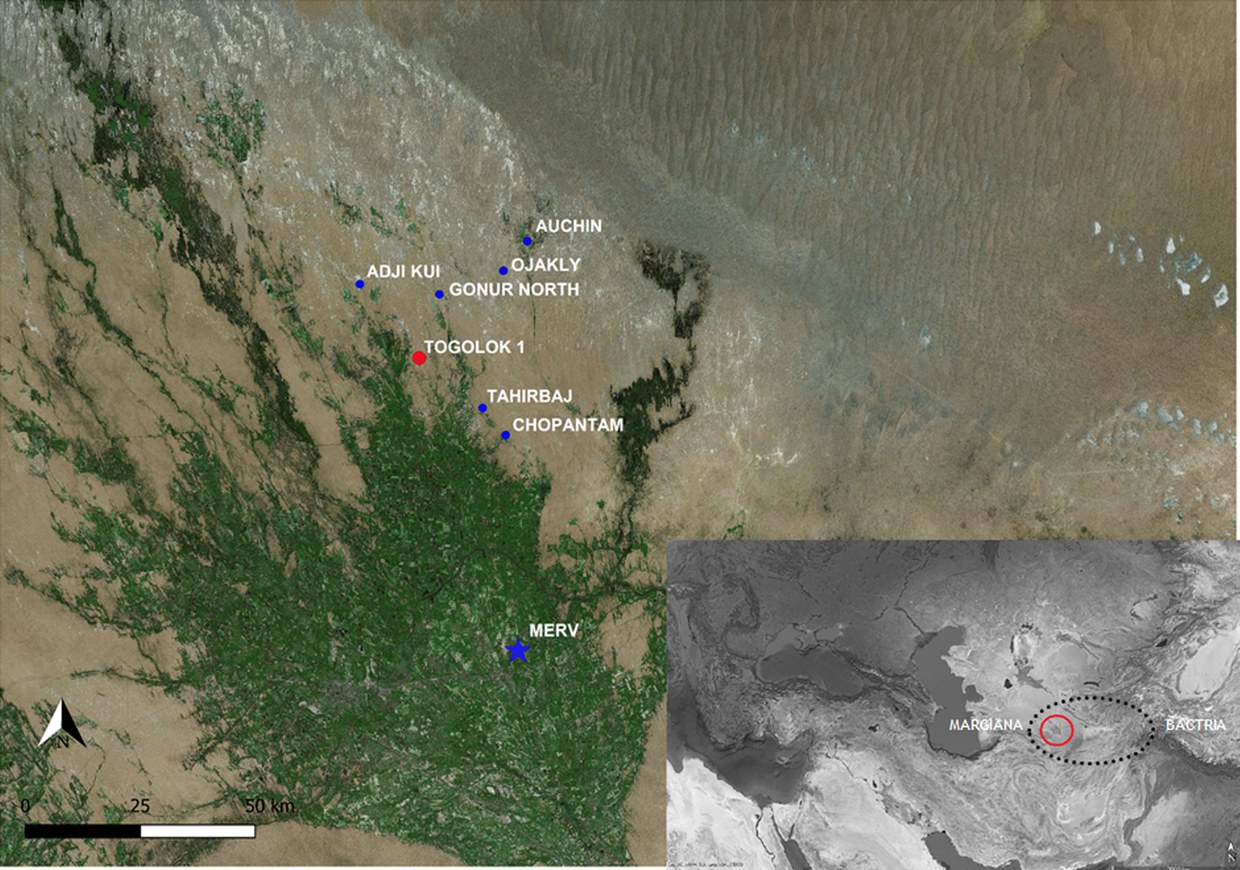
Fig. 1
Overview of the main archaeological sites in the area of the alluvial fan of the Murghab River (basemap: Landsat 8).
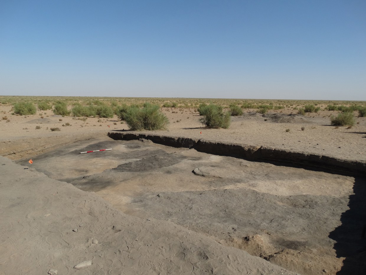
Fig. 2
Overview of the excavation at the end of the 2015 Archaeological Mission. The investigations identified not permanent structures used by agro-pastors as shelter (Late Bronze Age, 1880-1620 BCE).
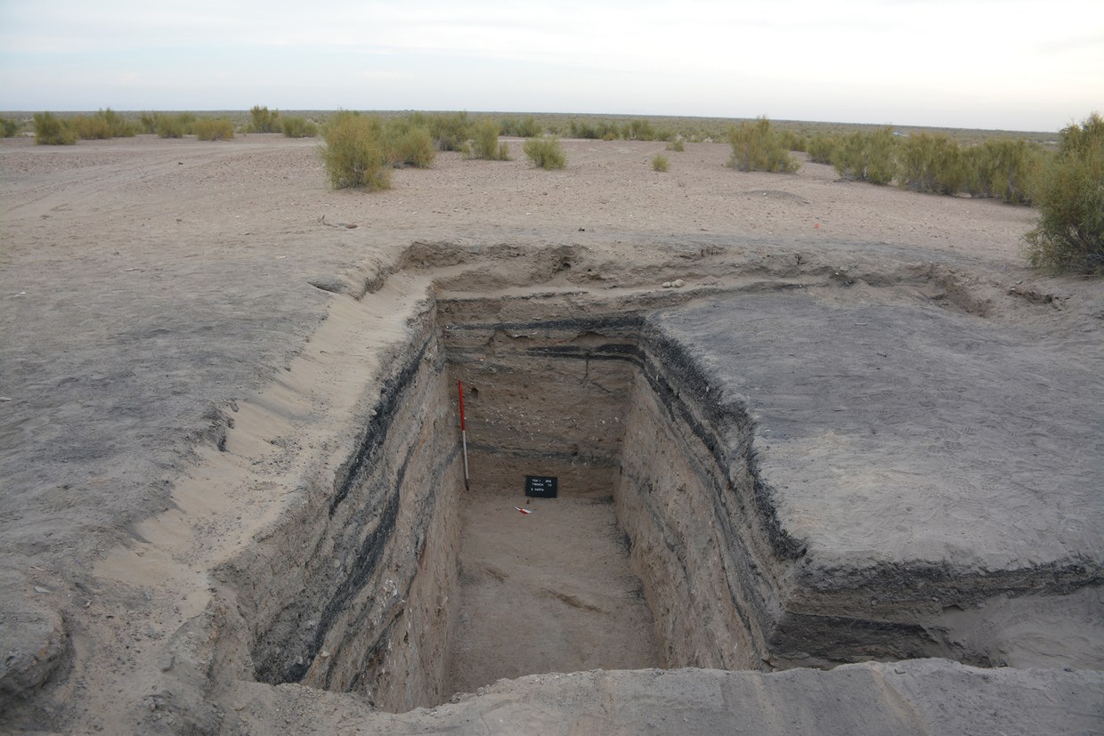
Fig. 3
Refuse area related to the living quarter of BMAC culture located further south (end Middle Bronze - early Late Bronze Age, 2287-1873 BCE).
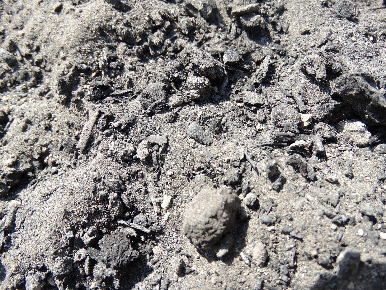
Fig. 4
Archaeobotanical remains excavated in the area interpreted as a livestock enclosure.
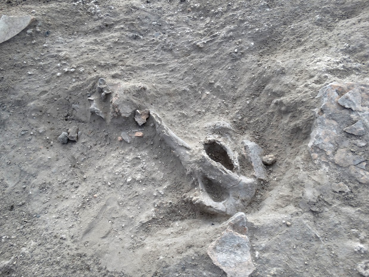
Fig. 5
Archaeozoological remains, interpreted as meal scraps, excavated in the large fireplaces located in the area of temporary shelter.
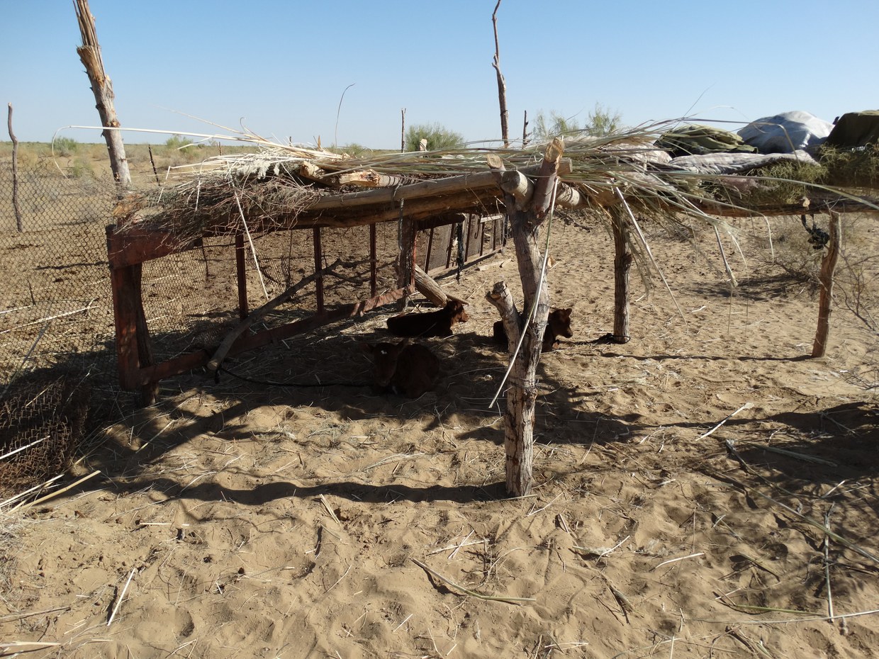
Fig. 6
Ethno-archaeological comparison with modern Turkmen pastoral camps, located along the border with the Karakum Desert in the Murghab region.
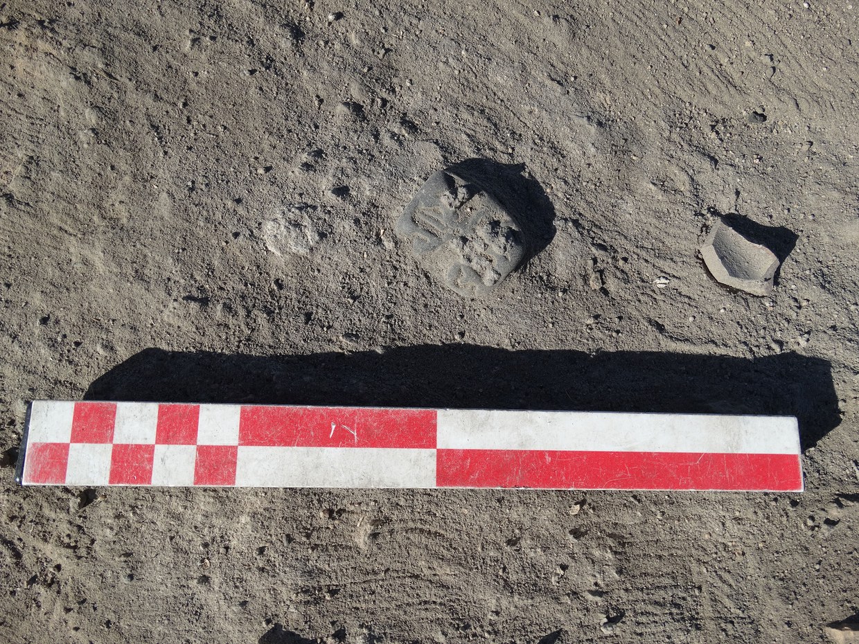
Fig. 7
Discovery of a black-chlorite seal-amulet in the area of livestock enclosure.
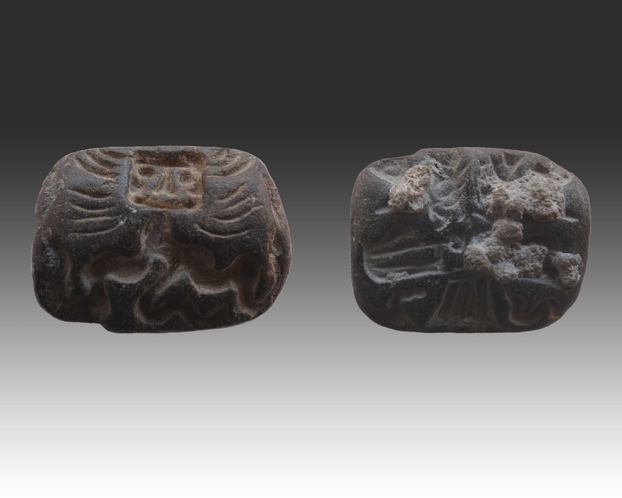
Fig. 8
Black-chlorite seal-amulet, depicting on one side a serpetine body, typical of the Bactrian-Margian glyptic; on the other side, a bird of prey with femail attributes.
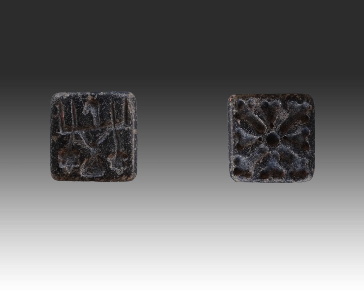
Fig. 9
Black-chlorite seal-amulet, depicting on one side a stylized bird of prey; on the other side, a rosette motif with a central button.
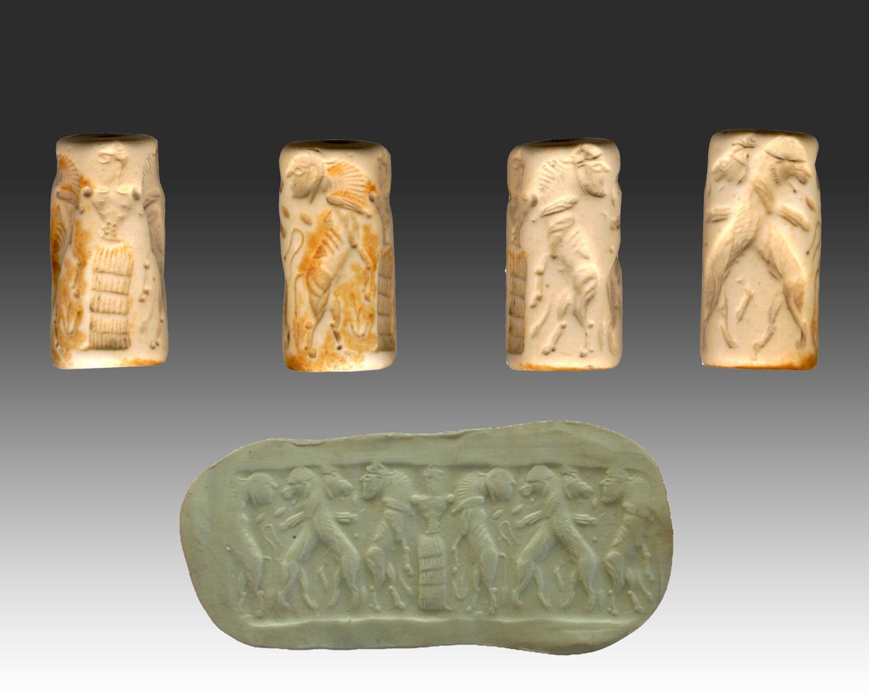
Fig. 10
White-stone cylindrical seal, depicting a human figure defending two bull-men attacked by two lions. Local reworking of a scene, typical of Mesopotamian glyptic.