Karkemish (Turkey)
Turco-Italian Archaeological Expedition at Karkamış Höyük
Archaeological mission coordinator/director
Nicolò Marchetti (DiSCi, University of Bologna)
Research Area and ERC Panels
- Archaeology from pre and proto history to medieval age
- SH6 The Study of the Human Past: Archaeology and history (3rd level 12)
Activation date of the campaign
The project started in 2011, in collaboration with the universities of Istanbul and Gaziantep
General description
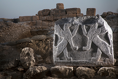
The exploration of Karkamış Höyük (ancient Karkemish) (36°49'46.36"N, 38°0'59.26"E) by the Turco-Italian Archaeological Expedition has started in 2011 (Fig. 1). Its main aim is the comprehension of the history of the site through its uninterrupted archaeological sequence, which stretches from the Chalcolithic Era (5th millennium BC) to the early Islamic period (10th century AD). The most impressive phases are dated to the Late Bronze Age, when Karkemish, reknown already for its temple dedicated to the goodness Kubaba, became the leading centre of the Hittites in the northern Syria (the second born or the brother of the Great King was usually in charge of the city), and to the Iron Age.
In this latest period, the city controlled an independent powerful state, which was absorbed by the Neo-Assyrian Empire only at the end of the 7th century BC (Fig. 2). The site is also noteworthy for the battle between Nebuchadnezzar II of Babylonia and the Egyptian troops sent to assist the last Assyrian resistance (summer of 605 BC), after which the Neo-Babylonian winners sacked the city. Meaningfully, the archaeological investigation concentrated on these levels. After been occupied by an Achaemenid village, the site was resettled as a Hellenistic foundation named Europos, followed by an Imperial Roman occupation with an important Late Antique phase. The, it became a village again in the Abbasid period.
Karkemish is on the right bank of the Euphrates river, but it is divided in two parts because of historical and political events connected to the First World War, the collapse of the Ottoman Empire and the Turkish War of Independence (1918-1922). The main two units, the Acropolis and the Inner Town, are part of modern Turkey, within a military base, a situation that prevented looting activities. The Outer Town, divided from the rest of the site by a massive rampart fortification dating to the Middle Bronze Age, is splitted between Turkey and Syria. A small town with the same name of the site is present on the Turkish side, while in Syria the modern city of Jarabulus (which comes from Europos, the name of the site in the Hellenistic-Roman period) is partially overlapping the ancient settlement. The hill of Yunus, near the site, was employed as cemetery from the early Iron Age until present days.
The site was identified as the ancient Karkemish by G. Smith in 1876, then investigated on the behalf of the British Museum by P. Henderson in 1878-1881, by D.G. Hogart, R.C. Thompson and C.L. Woolley (who successfully directed the excavations of Ur and Alalakh in the following years), with T.E. Lawrence as assistant (better known as Lawrence of Arabia) between 1911 and 1914, and for a last campaign in 1920 by C.L. Woolley with P.L.O. Guy. Then, the site was integrated within a base of the Turkish army. Soldiers built several small barracks and shelters, often employing blocks dating to the Roman period or pieces of Iron Age basalt sculptures, and occupied the former house of British archaeologists on the site and the annexed warehouse for ancient materials. The Acropolis suffered the worst damages, because of many military installations. Finally, the site has been completely mined since 1956, while mine-clearing operations have started only little before the starting of the new excavation project.
The renewed excavations, which started in 2011 under the direction of prof. Nicolò Marchetti (Alma Mater Studiorum - Università di Bologna) with prof. Hasan Peker (Istanbul Universitesi) as deputy director, want to uncover in detail the urban history of the site and to create an open-access archaeological park, which was opened from July 2019. The musealization of the site of Karkemish passes through the creation of paths and observation points for tourists (Fig. 3). The main goal is to make the site available to local people, marking a point few meters from overturned Syria.
Album
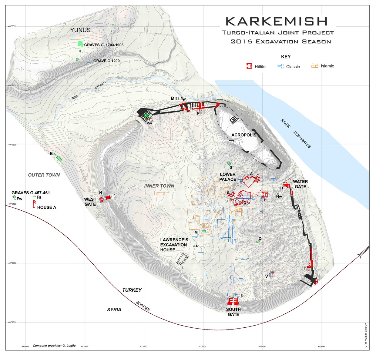
Fig. 1
Topographic map of Karkamış Höyük
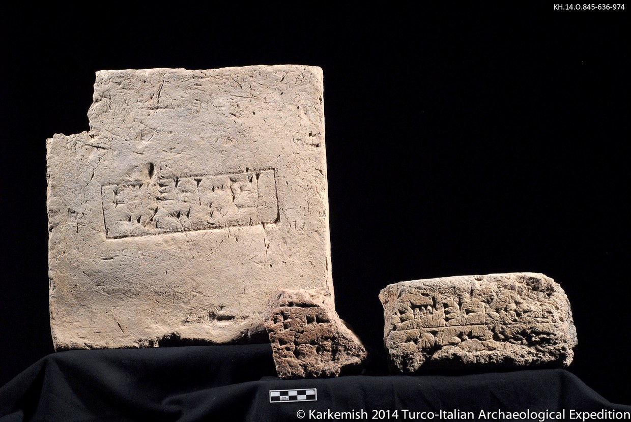
Fig. 2
Mudbricks with the cuneiform inscription of Sargon II of Assyria, “Palace of Sargon, king of the world, king of Assyria”
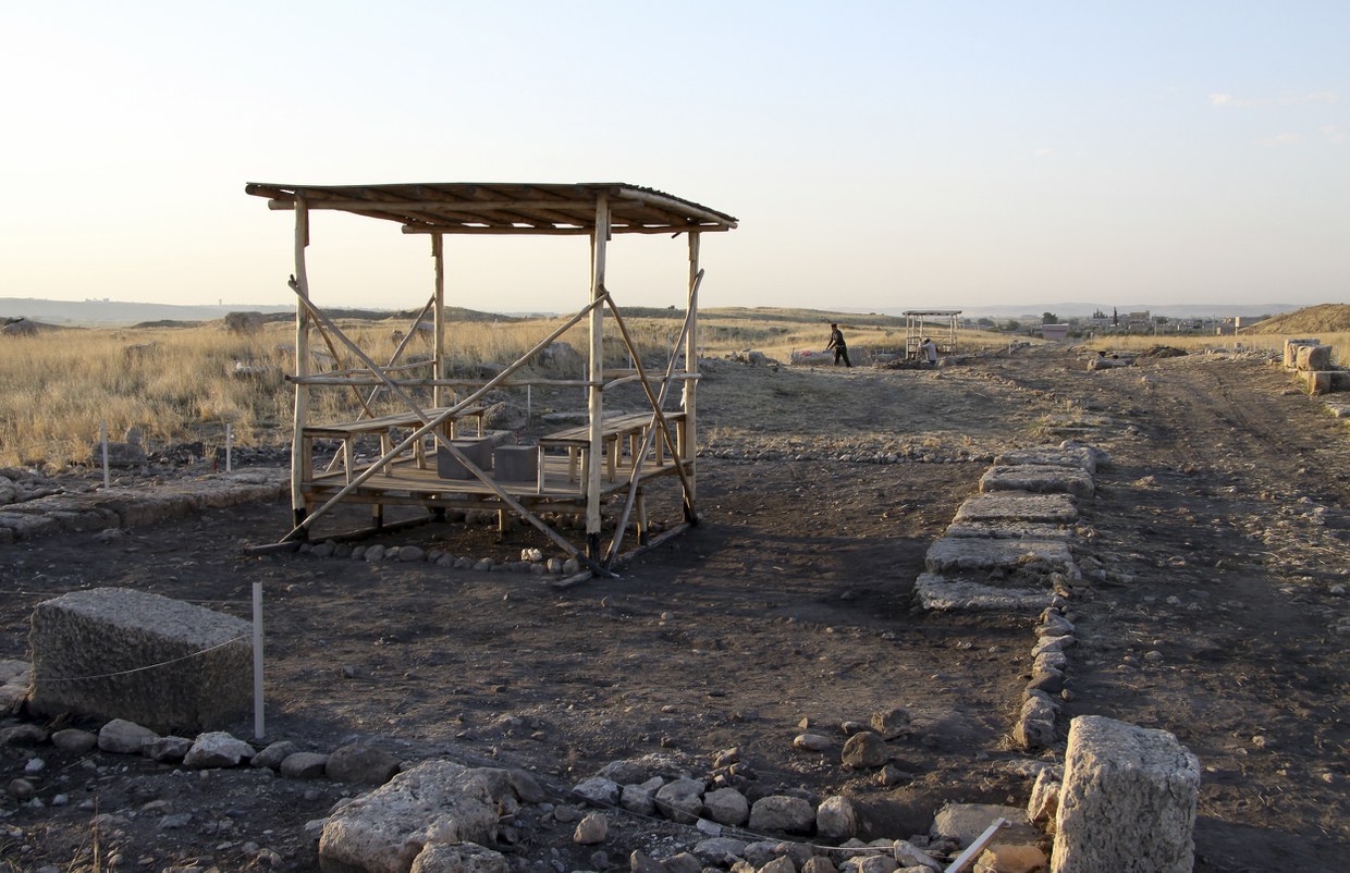
Fig. 3
Musealization of the site, through the creation of paths and wooden shelters