Excavations
The site has been investigated several times between 1878 and 1920 by archaeological expeditions on behalf of the British Museum and, since 2011, by a joint Turco-Italian project.
The site was occupied without interruptions from the 5th millennium B.C. to the 10th century A.D. and displays a significant monumental evidence referred to the Hellenistic-Roman Period (remains of the Columnated Street and the agorà/forum), confirmed by epigraphic data. However, the Turco-Italian excavations focused on the Bronze Age and Iron Age phases, when Karkemish had a leading role directly controlling on the middle Euphrates valley.
British excavations uncovered a large monumental complex at the footstep of the Acropolis, the so-called Lower Palace Area, where several palatial and ceremonial buildings dating back to the Iron Age can be distinguished. King’s Gate, which was the main entrance to the Palace from the Inner Town, was the first step of a ceremonial route which connected the Storm-God Temple, the Great Staircase (enclosed to the west by the relevant decorative complex of carved orthostats (the Long Wall of Sculptures), the Hilani and ending on the banks of the Euphrates to the Water Gate, connected to an extensive defensive fortification wall (River Wall) with casemates. Other monumental evidence referring to the Neo-Hittite Katuwa’s Palatial complex, as the Herald’s Wall and the Processional Entry, has been uncovered by the BM expedition (Fig. 4). Further investigations on the outskirts of the city were focused on the city gates (South Gate and West Gate) while on the Acropolis the Temple of Kubaba, the tutelary deity of Karkemish, was uncovered. In the Outer Town, beyond the fortification ramparts (probably built in the Middle Bronze Age), two residences dating back to the Late Iron Age period (Houses A-H) were investigated. Finally, trenches were opened on the Yunus hill, north-west to the site, to investigate the Iron Age cemetery.
The renewed operations of the Turco-Italian team have been organized in the same areas previously investigated by the British, in order to better understand the stratigraphy of the site: the Water Gate (Area H), the South and West Gates (respectively Areas D and N), the Hilani (Area B), the Storm-God Temple and the Great Staircase (Area A). However, several other excavation areas have been opened in the Inner Town: operations in Areas C and S uncovered the large palatial complex directly connected to the King’s Gate (Fig. 5), with occupation phases stretching for the Late Bronze Age (Fig. 6) to the end of the Iron Age (Fig. 7), including the Neo-Assyrian period following the conquest of the city by Sargon II, which extended the Palace and equipped the central courtyard with a pebbled floor with a chessboard pattern of black and white pebbles. Material as fragments of cuneiform tablets and tokens (found in the filling layer of a well in the palace) (Fig. 8) found during excavations confirmed administrative operations were performed in the complex. Area P, opened near the North-Western Fort, allowed to understand the defensive battlement system in the western part of the city. Area G, at the footstep of the Acropolis, is a deep sounding which provided a general sequence of stratified material from the Islamic period back to the Middle Bronze Age. Several other areas (M, Q, T, V) have been opened in other part of the Inner Town, to understand the settlement layout in pre-Classical and Classical periods.
The latest campaigns allowed also a limited investigation of the western part of the Acropolis, where a large monumental building with mudbrick walls dating to the Late Bronze Age was uncovered. Further limited investigations have been performed in the Outer Town (Areas E, F), displaying the evidence of both residential and funerary contexts dating to the late Iron Age and Achaemenian period (Fig. 9), while new trenches at Yunus brought to the uncover of several burials mainly dating the Iron Age. During latest campaigns, excavations focused also on the western part of the Acropolis (Area AA), where a large building dating to the Late Bronze Age has been uncovered.
Finally, interesting operations involved the uncover of the British Excavation House (Area L) (Fig. 10), also re-occupied by Turkish military after the definitive departure of British archaeologists in 1920 and still partially visible at the beginning of the Turco-Italian project in 2011. Other modern structures, as Turkish barracks and a Water Mill have been investigated, in the perspective of reconstructing the history of the site also in later times.
Album

Fig. 4
Basalt high-relief with a couple of rampant griffins (reign of Katuwa - Iron Age II)

Fig. 5
Aerial view of the palatial area at the footstep of the Acropolis (Area C)

Fig. 6
Clay cretulae connected to palatial administrative practices (Hittite period - Late Bronze Age II)

Fig. 7
Orthostats with processions of gazelles’ bearers, part of the decorative system of the Neo-Hittite and Neo-Assyrian Palace (Neo-Assyrian period - Iron Age III)
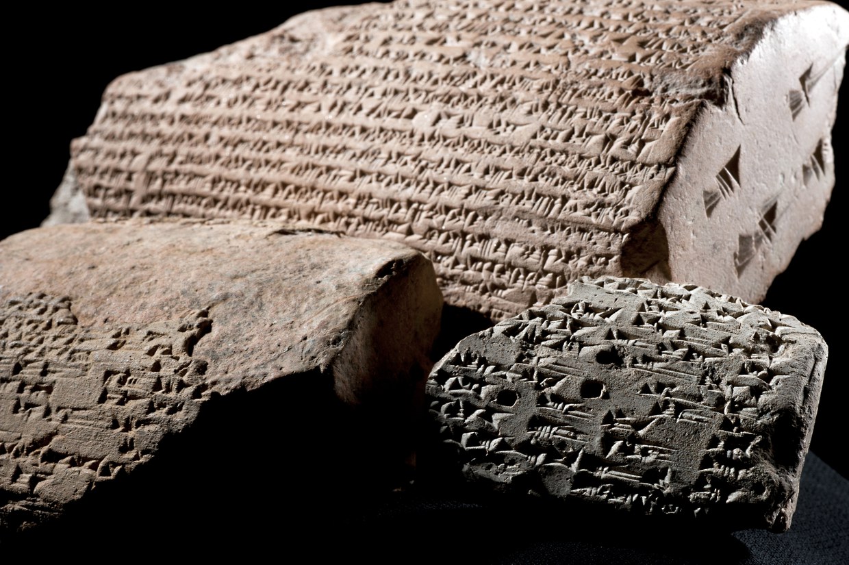
Fig. 8
Fragments of inscribed cylinders with cuneiform text of Sargon II (Neo-Assyrian period - Iron Age III)

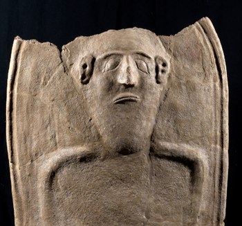
Fig. 9
Lid of an anthropoid sarcophagus from the Outer Town (Achaemenid period – Iron Age IV)
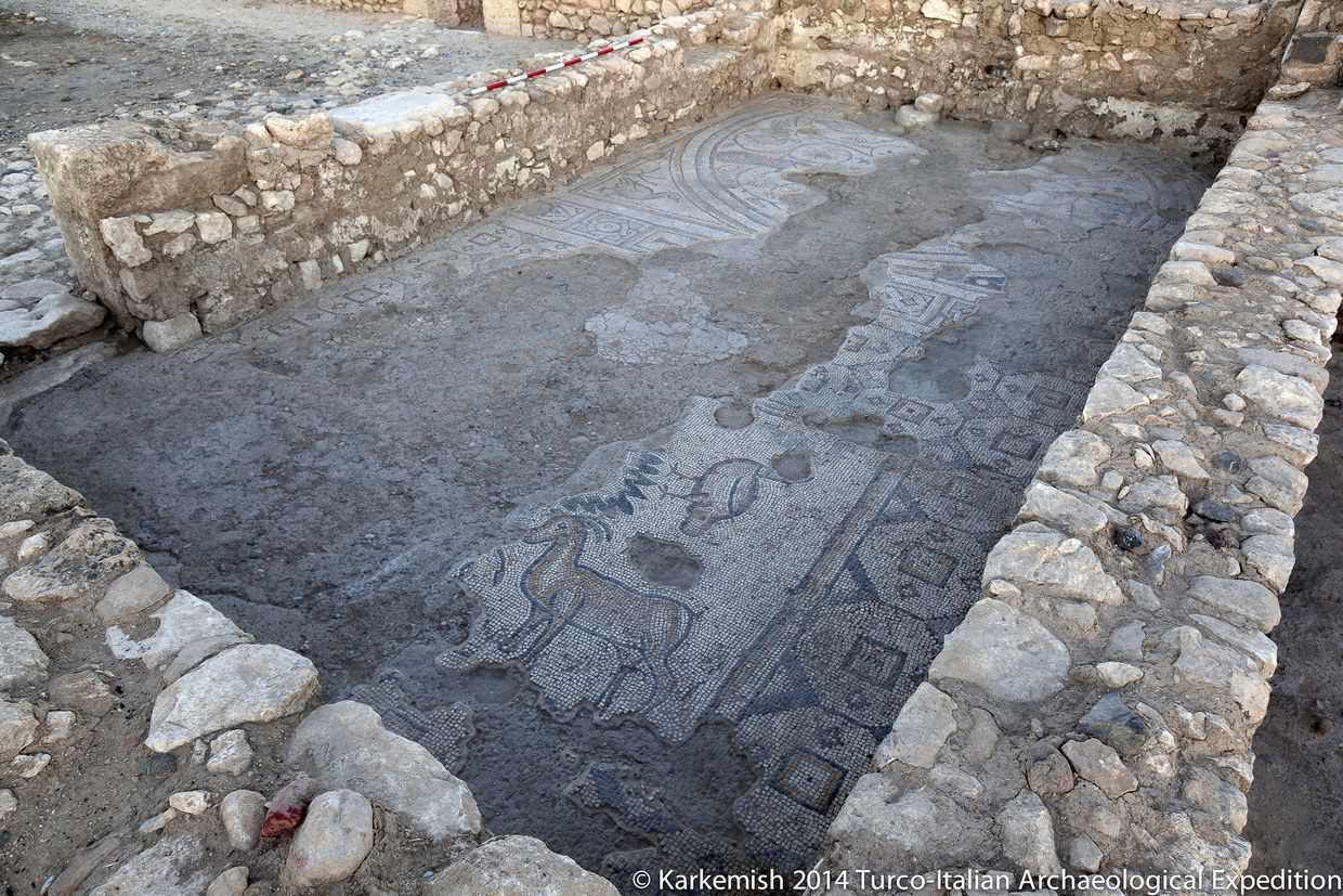
Fig. 10
Mosaic with animal features dating back to the Late Roman/early-Byzantine period. It has been re-used in the Excavation House built be British archaeologists in 1912